Op-Ed: New D65 Boundaries Make No Sense
A brief review of the new District 65 Boundaries
In last Tuesday’s meeting, the District 65 administration presented their new financial plan to the Board. This plan involves significant family-facing austerity: closing two schools, ending SACC/head-start, laying off instructional staff, and increasing student fees. I have a lot to say about the financial projections (stay tuned) but I briefly want to write about the boundaries.
There’s also a reddit thread on this subject with further discussion and a survey. While you’re at it, you should also take D65’s Community Superintendent survey.
First, you can see maps below or in the plan:
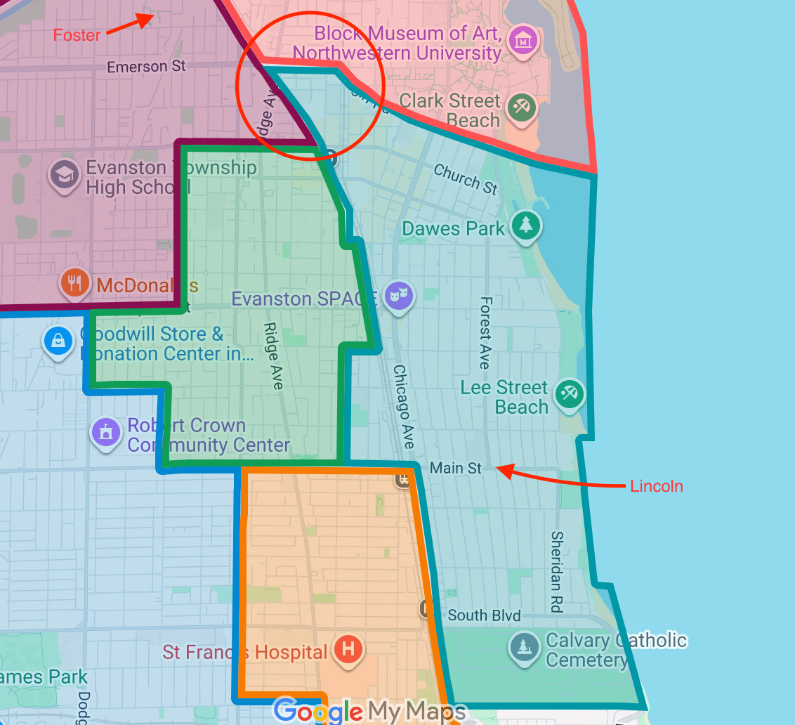
Lincoln Elementary is probably the weirdest new boundary. You can live by the Farmer’s market, along Emerson, north of Downtown, yet your students will go to Lincoln, all the way on the other side of town. Forget about walking, this is a ten minute drive! Yet, Foster is right there. Maybe the intent is to prevent students from crossing McCormick, but this is literally the fifth ward (City Ward Map). The whole point of the Foster School was to not put those kids on the bus!
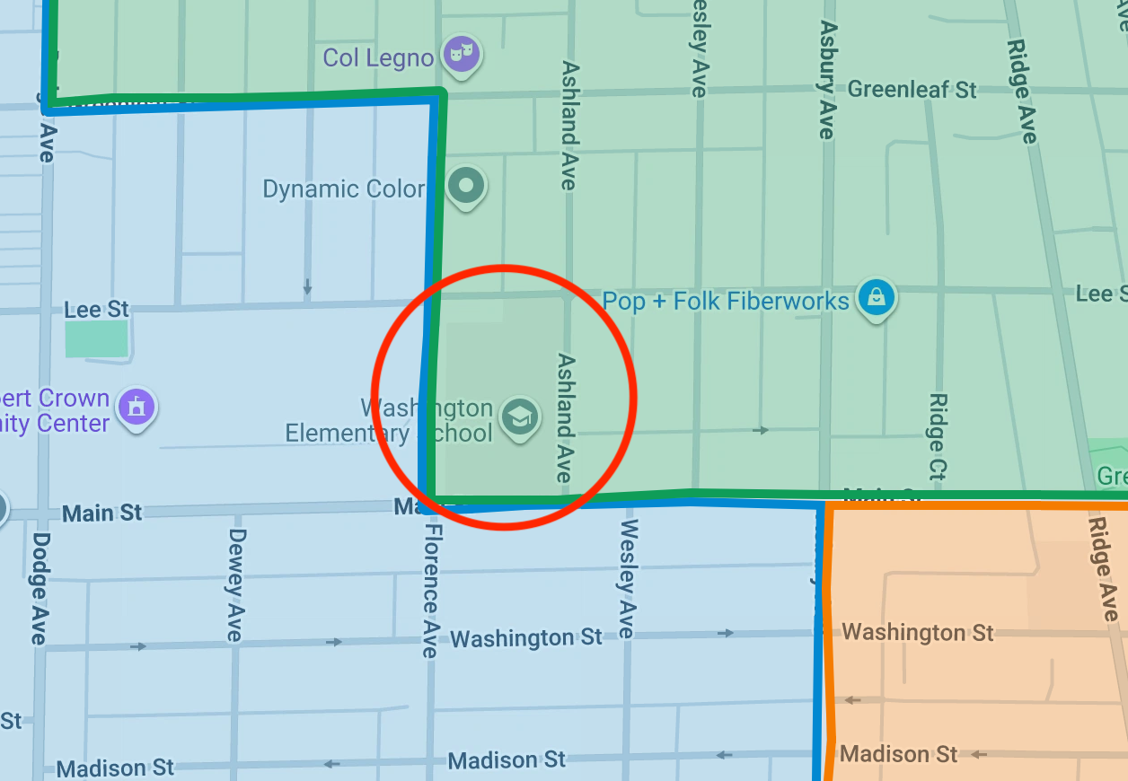
Here’s another example: Washington Elementary. With this plan, you could live across the street from Washington on two sides and not be sending your students there. The Robert Crown Center, literally next door, is not even in the proposed Washington zone! This is very different from the map this year. It’s hard not to feel like this zone is designed to make the case to close Washington next year.
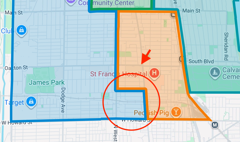
Here’s another example: Oakton Elementary. There are students in this block who can easily walk down Ridge to get to Oakton, but are now assigned to Dawes, a considerable hike away. Why?!
Even if you accept the closure plans, these changes needlessly make Evanston less walkable — they need to go back to the drawing room on this. Let me know what you think in the comments.